
Much of the country is in for a wet and windy weekend. Photo: Photo / 123RF
Much of the country is in for a wet and windy weekend, as a low moves up the country bringing severe weather.
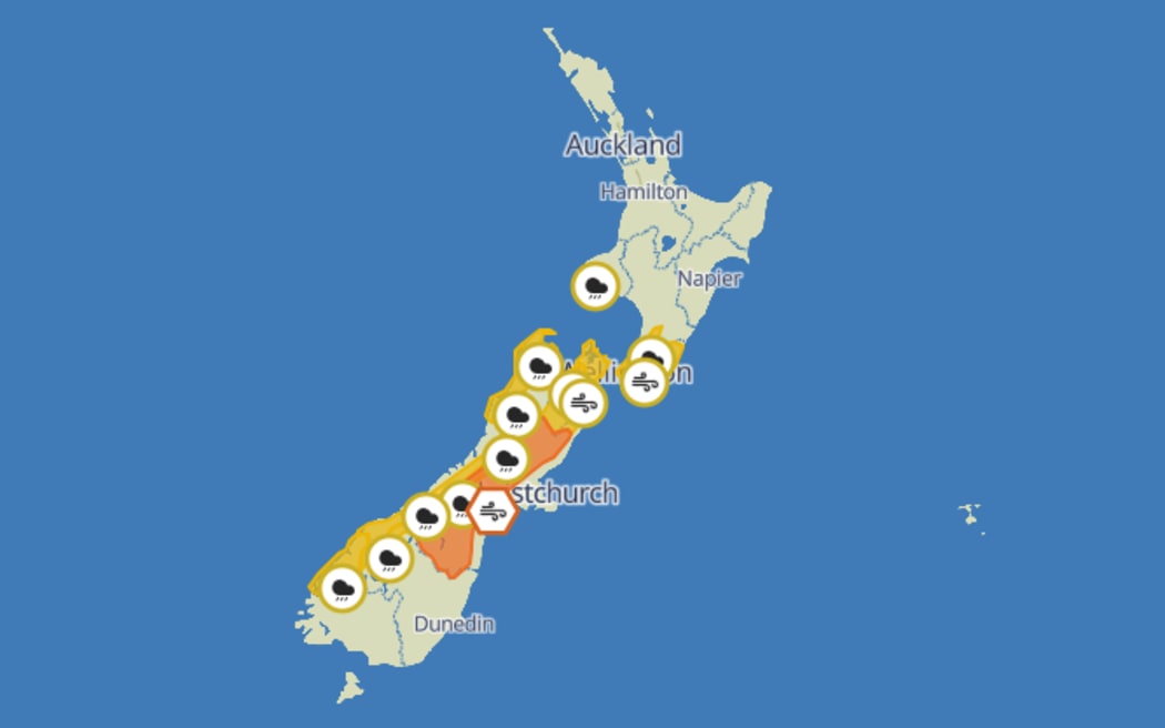
MetService said an active low pressure system from the Tasman Sea is forecast to move across the South Island late Saturday and early Sunday, preceded by heavy rain ad strong northwesterlies.
Meanwhile, an associated front is expected to move across the North Island on Sunday.
MetService has issued 10 heavy rain watches for Saturday night through to Sunday morning.
The heavy rain watches include:
- Tararua Range
- Mount Taranaki
- Richmond and Bryant ranges including the Rai Valley
- Ranges of Tasman northwest of Motueka
- Buller
- Ranges of the Grey District
- Ranges of the Westland District
- Fiordland north of Doubtful Sound
- Headwaters of the Canterbury Lakes and Rivers about and south of Arthur's Pass
- Headwaters of the Otago Lakes and Rivers.
MetService has also issued an orange strong wind warning for Canterbury High Country, and strong wind watches for Marlborough, Wellington and Wairarapa from Saturday night until Sunday morning.
MetService's severe weather warnings. Photo: MetService
MetService meteorologist Oscar Shiviti said the wind and rain are forecast to decrease in severity before moving onto the North Island on Sunday.
Shiviti said there was some good news, with nights expected to be less chilly due to warmer airmass from the northwest, which will provide a break from the frosts experienced this week.


